

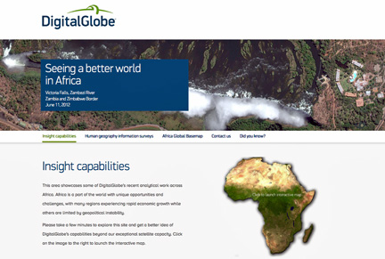
 [SatNews] Why focus on Africa? Africa is a region facing unprecedented growth over the next few years, but vexed with unique problems that put that expansion at risk.
Casey McCullar, the Senior Manager, Solutions Marketing, at DigitalGlobe, has introduced a new area within DigitalGlobe’s website that showcases some of the company’s recent work in Africa. Starting with the far-reaching imagery basemap, the talented teams build ever-richer information layers that allow deeper analysis of what is happening on any part on the world’s surface.
Whether it’s the predictive analytics team forecasting future events based on geospatial factors, DigitalGlobe’s R&D scientists determining crop growth from our 8-band imagery, the image analysts adding context to world events, or the Tomnod team harnessing the collective knowledge of the general public to answer tough questions, DigitalGlobe is building an indispensable repository of information about our changing planet.
The five satellites that make up the DigitalGlobe constellation pass over almost every part of the Earth’s surface every day. Why focus on Africa? Africa is a region facing unprecedented growth over the next few years, but vexed with unique problems that put that expansion at risk. Africa has seen rapid inflows of foreign direct investment recently—estimates reveal that Africa is likely to experience GDP growth that outshines developed countries over the next few years. Combine that with its growing population and abundance of natural resources, and Africa is well positioned for advancement. However, instability and violence within the region threatens to hinder this expansion.
The website DigitalGlobe has put together is designed to allow visitors to focus on the topics that are of most interest to them. One look at the site’s interactive map shows that the work has been distributed all over the continent. Site visitors can explore the work that’s been completed in a specific country of interest, or select only a specific type of analysis. Also featured is the Human Geography Information Surveys, geographic datasets that describe population groups by specific attributes—religion, language, cultural affiliation—the elements that make us—us. Of course, all of this is built on the most current high resolution satellite imagery available in DigitalGlobe’s Global Basemap.
When you visit the site, you’ll see that was is being worked on is far more than just providing the clearest view of the Earth. Through analytics and insight capabilities, you might learn something new you didn’t know before, or at least see something familiar in a brand new way. DigitalGlobe wishes to enable its customers to make the world a better place and help fulfill their critical business needs. You can check out this showcase of some of the firm’s most recent work by clicking on the graphic above.
