
 [SatNews] China has launched a new high-resolution remote sensing satellite….
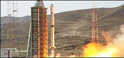
….on Monday at 03:17 UTC using the Long March 4B (Chang Zheng-4B -Y26) launch vehicle from the Taiyuan Satellite Launch Center. According to the official Xinhua News Agency, the ZiYuan-3 is the country’s first high-resolution geological mapping satellite, to be used for civil purposes. The ZiYuan-3 (ZY-3) is the first of a new series of high-resolution civilian remote sensing satellites, grown from a project that was initiated in March 2008. The new satellite carries three high-resolution panchromatic cameras and an infrared multispectral scanner (IRMSS). The cameras are positioned at the front-facing, ground-facing and rear-facing positions. Two cameras (front-facing and rear-facing) have a spectral resolution of 3.5m and 52.3km ground swath while the ground-facing camera has a spectral resolution of 2.1m and 51.1km ground swath. The IRMSS has a spectral resolution of 6.0m and 51.0km ground swath.
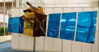
The ZiYuan-3 satellite.
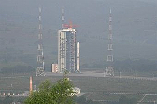
The Taiyuan Satellite Launch Center.

ORBCOMM’s VesselSat-2 microsatellite.