
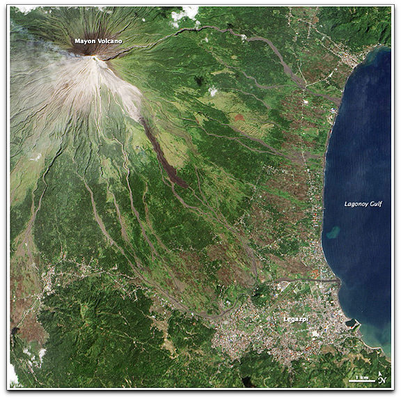
This natural-color image of Mayon was captured on December 15, 2009, by the Advanced Land Imager on NASA’s Earth Observing-1 (EO-1) satellite. A small plume of ash and/or steam is blowing west from the summit. Dark-colored lava or debris flows from previous eruptions streak the flanks of the mountain. A ravine on the southeast slope is occupied by a particularly prominent lava or debris flow. According to local news reports from December 16, fragments of lava were continuously detaching from the lava filing the crater and cascading down slope up to 3 kilometers. Lava flows reached several hundred meters from the summit, but they were still confined to ravines. Disaster planning officials speculated that, given Mayon’s history, evacuations could last more than two months. (Credits: NASA Earth Observatory image created by Jesse Allen, using EO-1 ALI data provided courtesy of the NASA EO-1 team. Caption by Rebecca Lindsey.)