
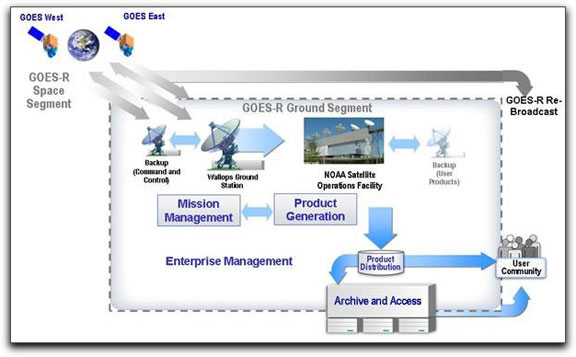
Today’s GOES satellites provide the images and time-lapse sequences familiar to most Americans in television weather forecasts. They are the primary tool used by NOAA to detect and track hurricanes, thunderstorms, tornadoes and other severe weather in the continental U.S. and western hemisphere. The nexgen GOES-R system will provide significantly improved image resolution. It will increase the rate of imagery coverage of earth surfaces from every 30 minutes to every five minutes in normal conditions — and every 30 seconds during severe weather events.