
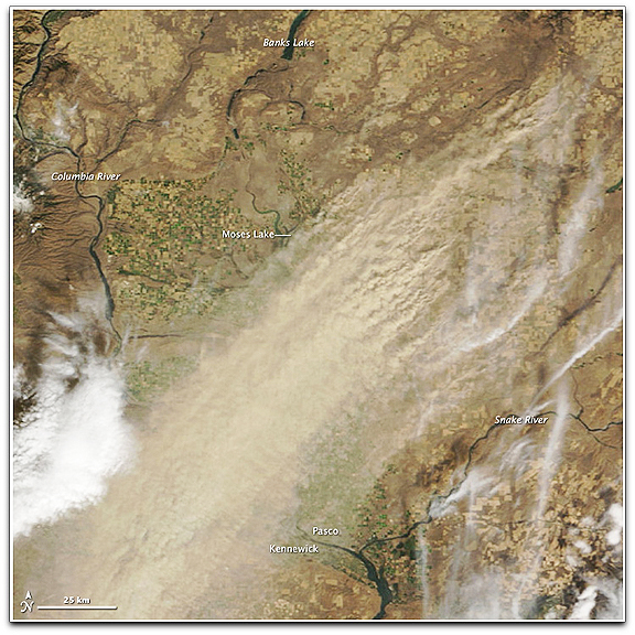
A thick, rippling plume of dust runs northeast to southwest through the center of the image. Dust stretches as far south as the cities of Pasco and Kennewick, which sit on opposite banks of the Columbia River. In the north, the dust seems to rise primarily from the pale golden squares of fields farmed using dryland agriculture, a common practice in arid eastern Washington. The dryland fields are larger and less colorful than the bright green and gold fields of irrigated agriculture near the Columbia and Snake Rivers in the center of the image. Dryland farmers rely entirely on rainfall to sustain their crops, and as a result, do many things to preserve moisture in the soil. Some of these practices — leaving a field fallow after harvest to allow water to build in the soil for a year or covering the field with dry soil to prevent underlying moisture from evaporating — make dryland agriculture very prone to dust storms. These fields are likely either fallow or newly planted, probably with winter wheat, a common dryland crop in eastern Washington. The dust storm persisted for several hours and was still visible when Aqua MODIS flew over the region at 2:00 p.m. local time. (NASA image courtesy Jeff Schmaltz, MODIS Rapid Response Team. Caption by Rebecca Lindsey and Holli Riebeek.)