
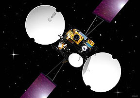
Artistic rendition of ESA’s Artemis satellite
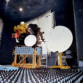
Testing of ESAs Artemis satellite in the Compact Payload Test Range (CPTR) in ESTECs Test Centre. Artemis (Advanced Relay and Technology Mission Satellite) is planned for launch in 2000 on Japan’s H2A vehicle to demonstrate new telecommunications techniques. The L-band payload will allow 2-way communications between fixed Earth stations and land mobiles (trucks, trains and cars) in Europe and North Africa. Two payloads will provide communications directly between satellites, receiving data from low Earth-orbiting satellites and relaying them to Europe. Credits: ESA
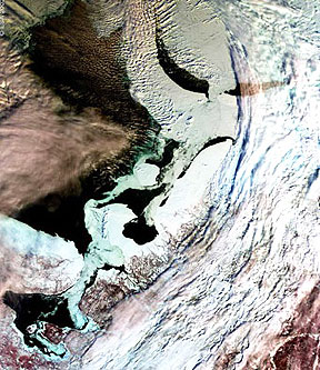
This is the first Medium resolution Imaging Spectrometer (MERIS) image obtained via ESA’s Artemis data-relay satellite. The image was acquired on the morning of 13 March over northern Russia. The area shows the coastline around the White Sea, with the City of Archangel to the southwest, opening up into the Barents Sea. The most prominent aspect of the image is the differentiation between the sea ice, clouds and the open water. Open water in the image is shown as black, where the white/grey areas in the sea represent sea ice. The sea ice can be made out clearly against the land masses particularly around the Kanin Peninsula and to the northeast.
Carrying three payloads plus a number of experiments, Artemis (Advanced Relay and Technology Mission Satellite) has been designed to test and operate new telecommunications techniques. The L-band mobile payload allows two-way voice and data communications, via satellite, between fixed Earth stations and land mobiles – trucks, trains or cars – anywhere in Europe and North Africa. Artemis carries two payloads for communications directly between satellites, which receive data from low-Earth-orbiting satellites and transmit them directly to Europe: -a laser-optical relay terminal called SILEX -a double S/Ka-band terminal called SKDR. ARTEMIS was launched 12 July 2001 by Ariane 5. It was initially placed in the wrong orbit and recovery operations have been underway since then to bring it to its final position. Credits: ESA-J.Huart
Dubbed ‘mission impossible’ at the time, and despite damaged onboard equipment, Artemis has demonstrated critical new technologies and continues in operation today. Artemis clocked up a number of unique firsts in space during its recovery. It created the first laser data link between satellites in different orbits; it was the first telecommunications satellite to be extensively reprogrammed in orbit; it was the first to use ion propulsion to reach geostationary orbit, 36,000 km up, after surviving the longest-ever drift to its destination.
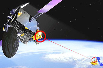
Using an experimental radio-frequency payload, Earth images collected by ESA’s Envisat 35,000 km below Artemis were delivered to customers almost in real time at a high rate. The same service was provided to France’s SPOT-4 observation satellite together with a second link via laser relay. Artemis also provided communications between ground controllers and Europe’s Automated Transfer Vehicles as the cargo ferries flew to the International Space Station.
In 2008, Artemis leapt into service at short notice during the ferry’s first mission when NASA’s system was shut down as Hurricane Ike struck the country. The ATV team in Toulouse, France, and their Artemis counterparts in Redu, Belgium, sprang into action. With only a few hours to prepare, they held contact with the vessel throughout the night of September 11th.
While Artemis is controlled via Telespazio facilities in Fucino, Italy, ESA’s Redu centre houses its Mission Control Facility to schedule the services for users and to maintain the different payloads. “Artemis has delivered tremendous service availability over its entire operational life at full satisfaction of final users,” says Daniele Galardini, Head of ESA Redu Centre and in charge of Artemis. “The capability and professionalism of the teams in Fucino and Redu are the basis of the Artemis achievements.”