

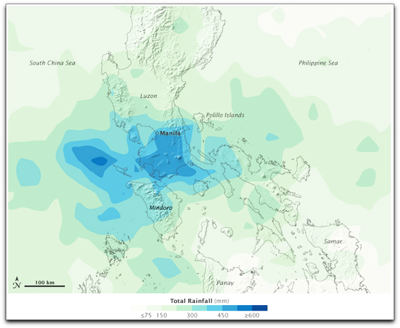
The estimates, acquired by multiple satellites, are calibrated with rainfall measurements from the Tropical Rainfall Measuring Mission (TRMM) satellite in the Multi-satellite Precipitation Analysis. The highest rainfall amounts — more than 600 millimeters (23.6 inches) — appear in blue. The lightest amounts appear in pale green. Gray shading indicates island topography of the Philippines. Rainfall occurs over the entire region shown in this image. The heaviest pocket of rain appears off the west coast of southern Luzon, over the South China Sea. A large expanse of heavy rain stretches from that locality across southern Luzon. An area of heavy rain also occurs immediately south of the capital city. The flooding that struck the region in late September 2009 was the worst in more than 40 years. Officials declared a “state of calamity” in Manila and 25 provinces affected by the storm.
