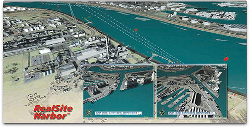
Harris developed the models as part of the nearly 500 global 3D HarborView models the company has produced during the past five years as a prime contractor for the U.S. government’s global geospatial mapping and charting services. HarborView blends Harris visualization software and production processes to render 3D models that integrate 2D, 3D, and satellite imagery data. The visualization application provides sophisticated analysis and measurement tools, including a 3D tidal surge feature that allows users to interactively raise or lower the predicted water level of the HarborView model. This simulated tidal surge quickly shows which areas may be at risk for flooding and how far inland an estimated tidal surge could reach. HarborView is part of Harris Corporation’s RealSite Harbor product family that uses varying resolution imagery and LiDAR data sources for 3D modeling, visualization, and analysis of seaports and harbors around the globe. RealSite Harbor models provide accurate, highly detailed representations for a wide variety of applications ranging from operations management and navigation safety to security planning, threat detection, disaster response and environmental planning.