
[Satnews] Launching July 22, 2015 will be Jason-3 the newest satellite in a series designed to maintain long-term satellite altimetry observations of global sea surface height.
These data provide critical ocean information that forecasters need to predict devastating hurricanes and severe weather before they arrive onshore. Over the long term, Jason-3 will help us to track global sea level rise, an increasing threat to the resilience of coastal communities and to the health of our environment.
Jason-3’s highly accurate altimetry measurements will be used for a variety of scientific, commercial and operational applications, including:
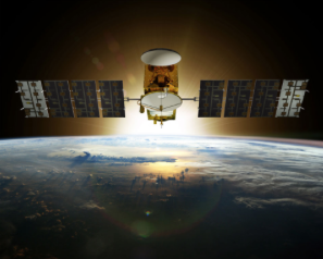
Artist rendition of the Jason-3 satellite. Image Credit: CNES/ill./DUCROS David, 2013
- Hurricane intensity forecasting
- Surface wave forecasting for offshore operators
- Forecasting tides and currents for commercial shipping and ship routing
- Coastal forecasting for response to environmental problems like oil spills and harmful algal blooms
- Coastal modeling crucial for marine mammal and coral reef research
- El Niño and La Niña forecasting
Jason-3 would not have been possible without a global partnership between Centre National d'Etudes Spatiales (CNES), European Organisation for the Exploitation of Meteorological Satellites (EUMETSAT), and the National Aeronautics and Space Administration (NASA), that freely shared scientific knowledge, financial support and a vision for the betterment of the global community.
Jason-3 is a satellite mission that supports scientific, commercial and practical applications related to sea level rise, ocean circulation, and climate change. Jason-3 follows the current operational altimeter satellite, Jason-2, in maintaining satellite altimetry observations of global sea surface height. Jason-3 is an international cooperative mission in which NOAA is partnering with the Centre National d'Etudes Spatiales (CNES, France’s governmental space agency), European Organisation for the Exploitation of Meteorological Satellites (EUMETSAT), and National Aeronautics and Space Administration (NASA).
Jason-3 will make highly detailed measurements of 'sea surface height', which is a measure used to study sea level rise—a critical factor in understanding Earth’s dynamic climate. Sea surface height data from altimetry satellites like Jason-3 are also used to study hurricane intensity, tsunami dynamics, El Niño Southern Oscillation, eddy dynamics, ocean boundary currents, coastal and shallow water tides, as well as weather and climate forecasting.