
These images from the SSTL-built UK-DMC2 satellite, which is part of the DMC constellation, show Moore before and after the tornado struck. The 17-mile long trail of destruction can be seen travelling from left to right across the centre of the image.
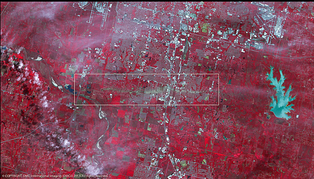
The huge Tornado that struck Moore in Oklahoma, on Monday the 20th May 2013, has left behind a clear path of destruction which can be seen across the centre of the image.
DMCii supplies satellite imagery products and services to a wide range of international customers from a unique constellation of satellites for agriculture, forestry, mapping and many more markets. The example above is the Raw Image data from our 22 Meter Multispectral Satellite split into the 3 spectral bands (NIR, Red and Green) with Radiometric Calibration on all bands.
UK-DMC2 Image © DMCii, 2013, All rights reserved.
Satellite imagery can be a vital resource for disaster monitoring, helping responders assess the damage, co-ordinate relief efforts and plan future defences. DMCii provides imagery of disaster zones regularly through the year and is a member of the International Charter: Space and Major Disasters; a global co-operation between member satellite operators that makes images from space freely available for disaster response.