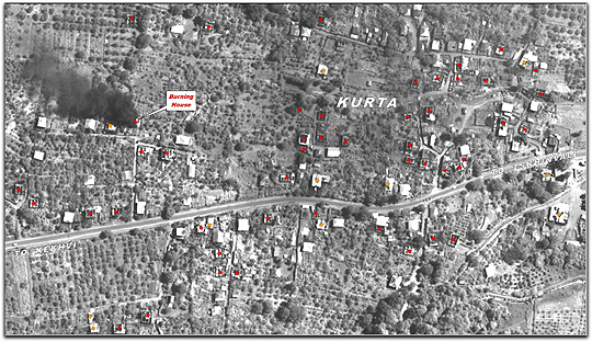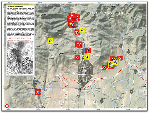
The map shows active fires in the ethnic Georgian villages on August 10, 12, 13, 17, 19 and 22, well after active hostilities ended in the area on August 10. On these dates, the lack of cloud cover allowed the satellites to view those locations. UNOSAT has also released a set of six high-resolution satellite images of the enclave of ethnic Georgian villages stretching nine kilometers north from Tskhinvali, showing that the majority of them have been destroyed. Human Rights Watch researchers spoke with several members of the Ossetian militias who openly admitted that the houses were being burned by their associates, explaining that the objective was to ensure that ethnic Georgians would not have the houses to return to — satellite imagery confirms the zeal with which this destruction is being undertaken. To see a photo study of the Georgian conflict, select this direct link…