• Skip to primary navigation
  • Skip to main content
  • Skip to primary sidebar
  • Skip to secondary sidebar
  • Skip to footer
  • NEWS:
  • SatNews
  • SatMagazine
  • MilSatMagazine
  • SmallSat News
  • |     EVENTS:
  • SmallSat Symposium
  • Satellite Innovation
  • MilSat Symposium
  • SmallSat Europe

SatNews

Satellite Industry Intelligence Since 1983

Subscribe
  • LATEST
  • SatNews Events
  • Magazines
  • Calendar
  • Subscribe
  • Missions & Constellations
    • Exploration & Science Missions
    • In-Orbit Servicing & Orbital Operations
    • LEO Constellations
    • Mission Autonomy & Onboard Systems
    • Mission Deployments & Manifests
    • Navigation & PNT
    • SmallSat
    • Spacecraft & Payload Technology
    View All in Missions & Constellations →
    China Accelerates Orbital Internet Deployment with Successful Smart Dragon-3 Sea LaunchChina Accelerates Orbital Internet Deployment with Successful Smart Dragon-3 Sea Launch
    Smallsats Dominate 2025 Launch Landscape as Mass Efficiency PeaksSmallsats Dominate 2025 Launch Landscape as Mass Efficiency Peaks
    MIT STAR Lab Expands Scope from Lasercom Innovation to Space Policy ArchitectureMIT STAR Lab Expands Scope from Lasercom Innovation to Space Policy Architecture
    Northrop Grumman Contracted for Hungary’s HUGEO Sovereign Communications SatelliteNorthrop Grumman Contracted for Hungary’s HUGEO Sovereign Communications Satellite
  • Business
    • Contracts & Commercial Deals
    • Earnings & Financial Reporting
    • Events & Conferences
    • Funding & Venture Capital
    • Market Forecasts
    • Mergers & Acquisitions
    • Personnel Moves & Appointments
    View All in Business & Finance →
    “SpaceX and the biggest IPO in history”“SpaceX and the biggest IPO in history”
    SmallSat Europe Speaker Focus: Chiara Manfletti, NeuraspaceSmallSat Europe Speaker Focus: Chiara Manfletti, Neuraspace
    SmallSat Europe Speaker Focus: Daniel Bock, Morpheus SpaceSmallSat Europe Speaker Focus: Daniel Bock, Morpheus Space
    Lockheed Martin Outlines Strategic Space Technology Roadmap for 2026Lockheed Martin Outlines Strategic Space Technology Roadmap for 2026
  • Defense
    • Counterspace & ASAT
    • Defense Budgets & Procurement
    • ISR & Reconnaissance
    • MILSATCOM
    • Missile Warning & Defense
    • National Security Programs
    • Space Domain Awareness
    View All in Military & Defense →
    NRL to Showcase Sovereign Space Capabilities at 41st Space SymposiumNRL to Showcase Sovereign Space Capabilities at 41st Space Symposium
    Northrop Grumman Minotaur IV Lofted USSF Tech Demonstration Payloads to OrbitNorthrop Grumman Minotaur IV Lofted USSF Tech Demonstration Payloads to Orbit
    The End of the VSAT Parts BinThe End of the VSAT Parts Bin
    Procurement Lag vs. Conflict Speed: Can Defense Buying Cycles Keep Up with Space Innovation?Procurement Lag vs. Conflict Speed: Can Defense Buying Cycles Keep Up with Space Innovation?
  • Gov
    • Export Controls & Compliance
    • International Space Agreements
    • National Space Policy
    • Space Law & Treaties
    • Space Sustainability & Debris Policy
    • Space Traffic Management / Debris Removal
    View All in Government & Regulation →
    FCC Modernizes Satellite Spectrum Rules to Unleash Next-Generation BroadbandFCC Modernizes Satellite Spectrum Rules to Unleash Next-Generation Broadband
    SmallSat Europe Speaker Focus: Dr. Ane Aanesland, ThrustMeSmallSat Europe Speaker Focus: Dr. Ane Aanesland, ThrustMe
    Isaacman’s Budget Math: How NASA Plans to Reach the Moon With a Quarter Less MoneyIsaacman’s Budget Math: How NASA Plans to Reach the Moon With a Quarter Less Money
    FCC Seeks Comment on Expanding Spectrum Access for “Weird Space Stuff”FCC Seeks Comment on Expanding Spectrum Access for “Weird Space Stuff”
  • Launch
    • Launch Providers
    • Launch Schedule & Calendars
    • Launch Sites & Infrastructure
    • Rocket Technology & Vehicles
    View All in Launch →
    What the SpaceX IPO Changes for Every Satellite OperatorWhat the SpaceX IPO Changes for Every Satellite Operator
    €30 million Financing for PLD Space’s Small Satellite Launcher€30 million Financing for PLD Space’s Small Satellite Launcher
    Satellite Deployers to be Used on JAXA Small Satellite Mission by ExolaunchSatellite Deployers to be Used on JAXA Small Satellite Mission by Exolaunch
    CAS Space Successfully Launches Kinetica-2, Aiming for Global Cost LeadershipCAS Space Successfully Launches Kinetica-2, Aiming for Global Cost Leadership
  • Software
    • Autonomous Ground Operations
    • Data Processing & AI/ML
    • Digital Twins & Modeling
    • Ground Segment & Teleports
    • Mission Planning & Simulation
    • Space Systems Software Engineering
    • Spectrum & Licensing
    View All in Software Automation & Ground Systems →
    Archangel Lightworks Secures £10M Series A to Scale Optical Ground InfrastructureArchangel Lightworks Secures £10M Series A to Scale Optical Ground Infrastructure
    Keysight and Sateliot Win ESA and GSMA Foundry Challenge for 6G InnovationKeysight and Sateliot Win ESA and GSMA Foundry Challenge for 6G Innovation
    Automation and Agility: How SSC Space Go is Designed for the New Age of GroundAutomation and Agility: How SSC Space Go is Designed for the New Age of Ground
    Intellian Unveils Future Military and Aerospace Antenna Technologies at Satellite 2026Intellian Unveils Future Military and Aerospace Antenna Technologies at Satellite 2026
  • Services & Apps
    • Climate & Environmental Monitoring
    • Disaster Response & Security Mapping
    • Earth Observation & Imaging
    • Maritime & Aviation Satcom
    • Satellite Communications
    View All in Services & Applications →
    Kraken Robotics Integrates KATFISH Sonar on SEFINE RD-22 USV Following Multi-Naval DemonstrationsKraken Robotics Integrates KATFISH Sonar on SEFINE RD-22 USV Following Multi-Naval Demonstrations
    Astroscale Plans World-First Multi-Orbit Satellite Inspection MissionAstroscale Plans World-First Multi-Orbit Satellite Inspection Mission
    The Downlink Deficit: The Pentagon’s Optical Mesh Network and the Terrestrial BottleneckThe Downlink Deficit: The Pentagon’s Optical Mesh Network and the Terrestrial Bottleneck
    Cinemo Reimagines the Vehicle as a Software-Defined Entertainment HubCinemo Reimagines the Vehicle as a Software-Defined Entertainment Hub

NOAA satellites monitoring severe weather + smoke

July 21, 2023

As catastrophic flooding impacts the Northeast, skies across the region and particularly along the central and eastern U.S. have also been affected by heavy smoke from wildfires burning across Canada that has continued to drift southward.

On Tuesday, July 18th., 2023, air quality alerts were issued to nearly 70 million people across the Lower 48 states. While some of the smoke affected the West and Midwest, including most of eastern Montana, eastern Nebraska, and northwestern Minnesota, by this time, the majority of it had spread to the eastern U.S.

Unhealthy (Code Red) air quality was observed in Georgia on July 18th., and air quality deemed Unhealthy for Sensitive Groups (Code Orange) was observed across parts of North Carolina, South Carolina, Tennessee, New York, Connecticut, Vermont, and New Hampshire.

At the same time, another round of storms brought even more rain to the Northeast this week as multiple rivers, creeks, and streams throughout the region are still flooding. With the ground still saturated from previous storms last week, flash floods were seen throughout the region, particularly in New York and Vermont.

Additionally, waves of slow-moving thunderstorms pushed through parts of the Midwest and South Tuesday night that dropped several inches of rain through where Kentucky, Illinois, and Missouri meet at the convergence of the Mississippi and Ohio rivers, prompting Flash Flood Warnings and Flood Watches in southern Illinois and western Kentucky.

On the morning of Wednesday, July 19th., Kentucky’s Governor, Andy Beshear, declared a State of Emergency due to widespread flooding, and tweeted that “…we’re working to assess the damage and respond…we will get through this together.”

The towns of Mayfield and Wingo were hit particularly hard with torrential rains, forcing some people from their homes and prompting several water rescues. According to the Kentucky State Mesonet, in Mayfield, 11.28 inches of rain had fallen in less than 24 hours on Wednesday. Western Kentucky has been experiencing a drought that local meteorologists believe may have worsened the effects of the flooding, since there was no time for the ground to soak up the heavy rain.

The same day in central North Carolina, a powerful tornado ripped through more than a dozen miles, destroying homes and injuring residents, according to officials. According to NOAA’s National Weather Service, a preliminary damage survey indicates that it was an EF3, with peak winds up to 150 miles per hour. This was the first EF3 tornado ever observed in central North Carolina in the month of July and the strongest twister for this time of year on record in the state.

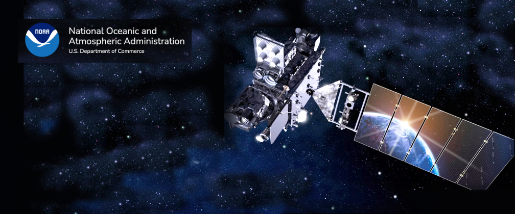
NOAA satellites have been closely monitoring this weather. GOES East (GOES-16) tracked the storms in near real-time. It also measured water vapor that was transported in the atmosphere to the Northeast, and tracked the storms that developed.

Artistic rendition of NOAA’s GOES East satellite on-orbit.

During a major flooding event, local forecasters and first responders rely on satellite data, along with other tools like aerial mapping, to understand the extent of the damage. NOAA flood products help identify where flooding may be occurring and aid officials in determining where to employ often limited resources during a flood.

Data from NOAA’s geostationary and polar-orbiting satellites are merged to create detailed and comprehensive flood zone maps. These maps help FEMA and first responders determine where to focus their efforts. They also allow for insight into where water is receding. This highly valuable information is given to community officials to help them determine, in combination with other critical resources, when it is safe for people to return to their homes.

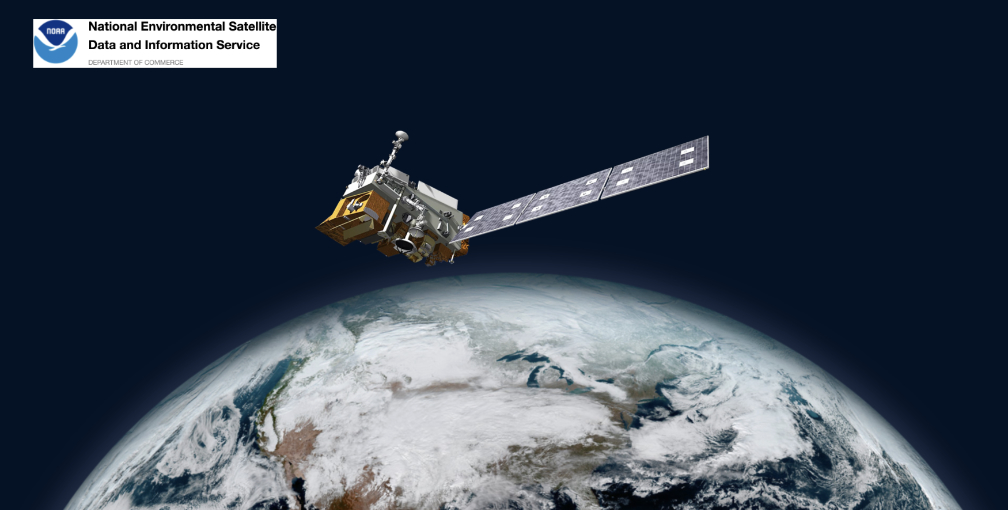
NOAA’s Joint Polar Satellite System (JPSS) measured the moisture in the air and total precipitable water helping forecast what areas would be severely impacted. Satellite data is used to produce flood maps of areas to help determine where to send aid.

Artistic rendition of NOAA’s JPSS on-orbit.

Both GOES East and GOES West (GOES-18) have been monitoring the wildfires in Canada as well as the smoke they are emitting, which continues to flow into the continental U.S. periodically.

The Joint Polar Satellite System’s NOAA-20 and Suomi NPP satellites also play an important role in detecting and tracking wildfires, especially in remote regions, where many of the current Canadian wildfires are raging. Their high spatial resolution imager detects smaller and lower-temperature fires and also provides nighttime fire detection. The data from these satellites is also critical for accurate predictions by NOAA smoke models, which are used by fire crews, first responders, and air traffic controllers.

From fires to floods, NOAA satellites will be watching.

Filed Under: Climate & Environmental Monitoring, Government & Regulation

Primary Sidebar

Coverage

  • Missions & Constellations
  • Business & Finance
  • Military & Defense
  • Launch
  • Software Automation & Ground Systems
  • Government & Regulation
  • Services & Applications

Most Read Stories

  • L3Harris Unveils XL-300P: The First P25 Handheld with 5G and Satellite Direct-to-Device Connectivity
  • SpaceX Loses Contact With Starlink Satellite
  • Rheinmetall Walked Away. Germany Should Take the Hint.
  • Rocket Lab Emerging as Potential Bus Provider for 2,800-Satellite Equatys Constellation
  • SpaceX Accelerates Record-Breaking IPO Following Trillion-Dollar xAI Merger

Secondary Sidebar

Footer


Satnews is a leading provider of satellite news, events, publications, research and other satellite industry information in both commercial and military enterprises worldwide.

Stories By Category

  • Business & Finance
  • Government & Regulation
  • Launch
  • Military & Defense
  • Missions & Constellations
  • Services & Applications
  • Software Automation & Ground Systems
  • Spectrum & Licensing
  • Startups & NewSpace Business

About Us

  • Leadership & Editorial Team
  • SatNews History
  • Free Satnews Subscription
  • SatNews Events
  • Magazines

Navigation

  • Latest Stories
  • Magazines
  • Events
  • Contact
  • Cookie & Privacy Policy for Satnews

We use cookies to ensure that we give you the best experience on our website. If you continue to use this site we will assume that you are happy with it.
x
Sign up Now (For Free)
Access daily or weekly satellite news updates covering all aspects of the commercial and military satellite industry.
Invalid email address
Notify Me Regarding ( At least one ):
We value your privacy and will not sell or share your email or other information with any other company. You may also unsubscribe at anytime.

Click Here to see our full privacy policy.
Thanks for subscribing!