• Skip to primary navigation
  • Skip to main content
  • Skip to primary sidebar
  • Skip to secondary sidebar
  • Skip to footer
  • NEWS:
  • SatNews
  • SatMagazine
  • MilSatMagazine
  • SmallSat News
  • |     EVENTS:
  • SmallSat Symposium
  • Satellite Innovation
  • MilSat Symposium
  • SmallSat Europe

SatNews

Satellite Industry Intelligence Since 1983

Subscribe
  • LATEST
  • SatNews Events
  • Magazines
  • Calendar
  • Subscribe
  • Missions & Constellations
    • Exploration & Science Missions
    • In-Orbit Servicing & Orbital Operations
    • LEO Constellations
    • Mission Autonomy & Onboard Systems
    • Mission Deployments & Manifests
    • Navigation & PNT
    • SmallSat
    • Spacecraft & Payload Technology
    View All in Missions & Constellations →
    The Silent Overhaul: How Software-Defined Routing and Cloud Ingestion Flattened the Aerospace Hardware StackThe Silent Overhaul: How Software-Defined Routing and Cloud Ingestion Flattened the Aerospace Hardware Stack
    Hybrid Earth Intelligence: NASA Expands Commercial Satellite Data Integration in $476M Cloud-Driven PushHybrid Earth Intelligence: NASA Expands Commercial Satellite Data Integration in $476M Cloud-Driven Push
    Hybrid Edge Mobility: Contrivian Launches “Horizon Plus” to Deliver Intelligent Multi-Orbit Field CommunicationsHybrid Edge Mobility: Contrivian Launches “Horizon Plus” to Deliver Intelligent Multi-Orbit Field Communications
    Space Tech vs. Biothreat: GMV Deploys Earth Observation and AI Core to Fight Invasive Pacific Seaweed in PortugalSpace Tech vs. Biothreat: GMV Deploys Earth Observation and AI Core to Fight Invasive Pacific Seaweed in Portugal
  • Business
    • Contracts & Commercial Deals
    • Earnings & Financial Reporting
    • Events & Conferences
    • Funding & Venture Capital
    • Market Forecasts
    • Mergers & Acquisitions
    • Personnel Moves & Appointments
    View All in Business & Finance →
    The Spatial Photonics Crunch: Inside the Invisible Supply Chain Threatening Orbital Laser NetworksThe Spatial Photonics Crunch: Inside the Invisible Supply Chain Threatening Orbital Laser Networks
    Sovereign Space Expansion: Spain’s FOSSA Systems Secures €9.25M to Scale Defense Constellation and SIGINT InfrastructureSovereign Space Expansion: Spain’s FOSSA Systems Secures €9.25M to Scale Defense Constellation and SIGINT Infrastructure
    Next-Gen Spatial Intelligence: BAE Systems Secures Agreement to Build High-Resolution Vantage Satellite Buses for VantorNext-Gen Spatial Intelligence: BAE Systems Secures Agreement to Build High-Resolution Vantage Satellite Buses for Vantor
    New Lobbying Force: Top NGSO Operators Unveil “SpaceConnect Association” in WashingtonNew Lobbying Force: Top NGSO Operators Unveil “SpaceConnect Association” in Washington
  • Defense
    • Counterspace & ASAT
    • Defense Budgets & Procurement
    • ISR & Reconnaissance
    • MILSATCOM
    • Missile Warning & Defense
    • National Security Programs
    • Space Domain Awareness
    View All in Military & Defense →
    Digital Twins for Space Command: Sedaro Tapped by Space Force to Build Federated Engineering PlatformDigital Twins for Space Command: Sedaro Tapped by Space Force to Build Federated Engineering Platform
    The Strategic Redistribution of Iranian Aerospace CapabilityThe Strategic Redistribution of Iranian Aerospace Capability
    Navigating Contested Battlespaces: Military GPS Receiver Market Approaches $3 Billion Amid Electronic Warfare SurgeNavigating Contested Battlespaces: Military GPS Receiver Market Approaches $3 Billion Amid Electronic Warfare Surge
    Preparing for Day One: DARPA Solicits Tech to Rebuild Destroyed Satellite Fleets Within HoursPreparing for Day One: DARPA Solicits Tech to Rebuild Destroyed Satellite Fleets Within Hours
  • Gov
    • Export Controls & Compliance
    • International Space Agreements
    • National Space Policy
    • Space Law & Treaties
    • Space Sustainability & Debris Policy
    • Space Traffic Management / Debris Removal
    View All in Government & Regulation →
    $3.57 Billion Milestone: FCC Advanced Wireless Services (AWS-3) Spectrum Auction Concludes$3.57 Billion Milestone: FCC Advanced Wireless Services (AWS-3) Spectrum Auction Concludes
    Who Has Authority to Intervene in a Space-Based Emergency?Who Has Authority to Intervene in a Space-Based Emergency?
    Staying in Their Lanes: SpaceX and Globalstar Join Forces to Defend Spectrum ExclusivityStaying in Their Lanes: SpaceX and Globalstar Join Forces to Defend Spectrum Exclusivity
    Orbital Paperwork War: China’s Spectrum Squatting Reserves 244,000 Satellite Slots to Combat SpaceX’s LEO MonopolyOrbital Paperwork War: China’s Spectrum Squatting Reserves 244,000 Satellite Slots to Combat SpaceX’s LEO Monopoly
  • Launch
    • Launch Providers
    • Launch Schedule & Calendars
    • Launch Sites & Infrastructure
    • Rocket Technology & Vehicles
    View All in Launch →
    Arianespace fights back – possibly!Arianespace fights back – possibly!
    Direct-to-Device Momentum: AST SpaceMobile Successfully Launches Giant Next-Gen BlueBird Satellites Atop SpaceX Falcon 9Direct-to-Device Momentum: AST SpaceMobile Successfully Launches Giant Next-Gen BlueBird Satellites Atop SpaceX Falcon 9
    SpaceX’s Secret ‘Starfall’ Capsule Wins FAA Approval for Pacific Reentry TestsSpaceX’s Secret ‘Starfall’ Capsule Wins FAA Approval for Pacific Reentry Tests
    Breaking the TRL Bottleneck: Space Phoenix Systems Debuts Cost-Effective Space Test-and-Return ServiceBreaking the TRL Bottleneck: Space Phoenix Systems Debuts Cost-Effective Space Test-and-Return Service
  • Software
    • Autonomous Ground Operations
    • Data Processing & AI/ML
    • Digital Twins & Modeling
    • Ground Segment & Teleports
    • Mission Planning & Simulation
    • Space Systems Software Engineering
    • Spectrum & Licensing
    View All in Software Automation & Ground Systems →
    Powering the Automated Floor: Intralogistics Operators Must Unify AGV Charging InfrastructurePowering the Automated Floor: Intralogistics Operators Must Unify AGV Charging Infrastructure
    Poland Sovereignty: GMV to Develop Core Ground Control Platform for CAMILA ConstellationPoland Sovereignty: GMV to Develop Core Ground Control Platform for CAMILA Constellation
    Software Over the Air: FatPipe Launches Acceleration Tool to Unclog Starlink and Amazon LEO LinksSoftware Over the Air: FatPipe Launches Acceleration Tool to Unclog Starlink and Amazon LEO Links
    Three LEO Operators Bet 2026 on a Supply Chain Built for 2027Three LEO Operators Bet 2026 on a Supply Chain Built for 2027
  • Services & Apps
    • Climate & Environmental Monitoring
    • Disaster Response & Security Mapping
    • Earth Observation & Imaging
    • Maritime & Aviation Satcom
    • Satellite Communications
    View All in Services & Applications →
    National SAR Defense: Norway Selects ICEYE for Nationwide Space-Based Flood and Hazard Monitoring SystemNational SAR Defense: Norway Selects ICEYE for Nationwide Space-Based Flood and Hazard Monitoring System
    Sovereign Milestone: OQ Technology Achieves Europe’s First Drone Video Transmission via 3GPP NTN LEO SatelliteSovereign Milestone: OQ Technology Achieves Europe’s First Drone Video Transmission via 3GPP NTN LEO Satellite
    Ghost Viewers trigger secondary ripple effect on Satellite Communications (SatCom)Ghost Viewers trigger secondary ripple effect on Satellite Communications (SatCom)
    Fleet-Wide Hybrid Networks: Marlink Integrates Starlink Across 80+ Oldendorff Carriers VesselsFleet-Wide Hybrid Networks: Marlink Integrates Starlink Across 80+ Oldendorff Carriers Vessels

Synspective Assesses Slope Instability-related Geohazards In Melamchi, Nepal With the World Bank and NDRRMA

March 24, 2022

The Government of Nepal investigated the land displacement hazards in the upstream part of the Melamchi River, Nepal in response to the destructive flood disaster that occurred there on June 15, 2021. The results demonstrated that Synthetic Aperture Radar (SAR) data and time-series interferometric SAR (InSAR) analysis-based Earth observation techniques have the capabilities to offer…

Synspective Inc., under the supervision of the World Bank and National Disaster Risk Reduction and Management Authority (NDRRMA), Government of Nepal, investigated the land displacement hazards in the upstream part of the Melamchi River, Nepal in response to the destructive flood disaster that occurred there on June 15, 2021. The results demonstrated that Synthetic Aperture Radar (SAR) data and time-series interferometric SAR (InSAR) analysis-based Earth observation techniques have the capabilities to offer a more cost-saving alternative to periodically monitor slopes with susceptibility and identify the potential precursors of slow-evolving failure conditions.

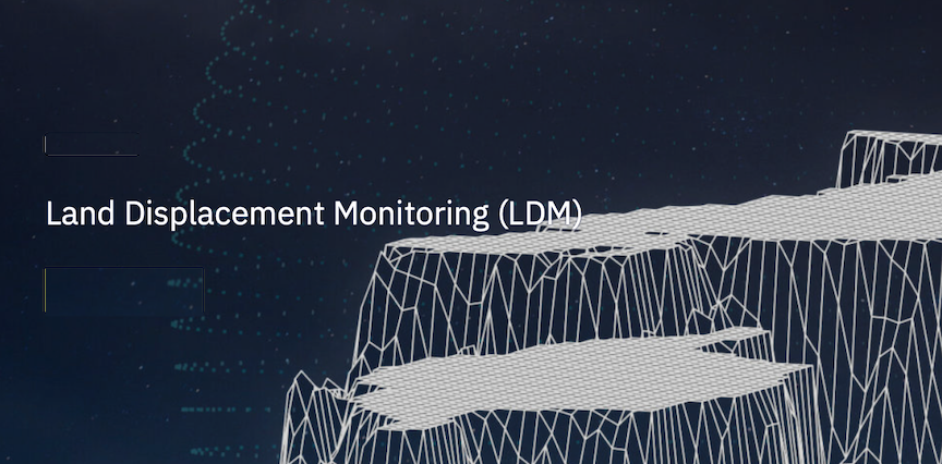
Using data gathered by the European Space Agency’s SAR satellite, Synspective’s Land Displacement Monitoring (LDM) service monitored over 400 km2 of slope area in the upstream proximity of the Melamchi River.  The analysis results were used to support the authorities’ work in managing slope susceptibility risk in the region. In addition to residential communities, critical facilities and lifeline infrastructure are also present in the region including the Headworks of the Kathmandu Valley Water Supply Improvement Project financed by the ADB.

“In the aftermath of a natural disaster,” Synspective CEO Motoyuki Arai said, “it is vital that local authorities have sufficient information to understand what happened and why, and they need this quickly. Conventional surveying techniques such as leveling, GNSS (Global Navigation Satellite System) sensor placement, drones, and helicopters, have been used for detecting and measuring land displacement and deformation. However, these survey methods are restricted to in-situ monitoring capabilities. Using InSAR technique and LDM technology, we were able to overcome the geographical accessibility challenges in Melamchi and provide insightful information that highlighted slope instability risks. On top of that, five months after the disaster, a helicopter survey confirmed our findings, which highlights the quality of information we can achieve using this monitoring technology. This project provides strong evidence of how the remote, wide and rapid data acquisition and the right analysis techniques can provide a great amount of support in disaster risk management, especially in difficult-to-access areas and under the recent COVID-19 mobility restrictions. And we believe this positive result can be a great boost to our company’s activities.”

Synspective’s analysis provides complementary insight in explaining ground failure mechanisms in the high-altitude area in the Himalayan region. In addition to the slope areas in the north-western Melamchi watershed, Synspective’s analysis highlights other catchment areas in the neighboring watershed and in other parts of Melamchi watershed as having susceptibility based on land displacement and spatio-temporal behavior and characteristics. It is also being discussed that it can be applied to risk monitoring of glacial lake outburst floods in the Himalayas, where the risk is increasing due to climate change.

The project benefited from technical discussions and reviews with the broader team including international and local experts and partners, and from various data shared from the field. We hope our output will be useful for government, relevant partners, and communities to plan resilient communities and infrastructure in Nepal.

Filed Under: Climate & Environmental Monitoring, Earth Observation & Imaging

Primary Sidebar

Coverage

  • Missions & Constellations
  • Business & Finance
  • Military & Defense
  • Launch
  • Software Automation & Ground Systems
  • Government & Regulation
  • Services & Applications

Most Read Stories

  • SpaceX’s Secret ‘Starfall’ Capsule Wins FAA Approval for Pacific Reentry Tests
  • American military space closed around one company in seven days
  • Analyst Projects Massive Subscription Growth for Starlink Ahead of Imminent SpaceX IPO
  • Major opportunities for 2 GHz over Europe
  • Amazon Leo Constellation Surpasses 330 Satellites Following Latest Atlas V Launch

Secondary Sidebar

Footer


Satnews is a leading provider of satellite news, events, publications, research and other satellite industry information in both commercial and military enterprises worldwide.

Stories By Category

  • Business & Finance
  • Government & Regulation
  • Launch
  • Military & Defense
  • Missions & Constellations
  • Services & Applications
  • Software Automation & Ground Systems
  • Spectrum & Licensing
  • Startups & NewSpace Business

About Us

  • Leadership & Editorial Team
  • SatNews History
  • Free Satnews Subscription
  • SatNews Events
  • Magazines

Navigation

  • Latest Stories
  • Magazines
  • Events
  • Contact
  • Cookie & Privacy Policy for Satnews

We use cookies to ensure that we give you the best experience on our website. If you continue to use this site we will assume that you are happy with it.
x
Sign up Now (For Free)
Access daily or weekly satellite news updates covering all aspects of the commercial and military satellite industry.
Invalid email address
Notify Me Regarding ( At least one ):
We value your privacy and will not sell or share your email or other information with any other company. You may also unsubscribe at anytime.

Click Here to see our full privacy policy.
Thanks for subscribing!