Here’s Looking @ Earth… The Prelude To Devastation + Destruction (Imagery)
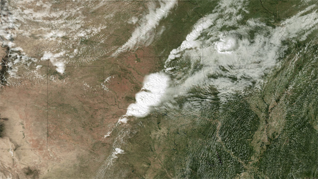
[SatNews] The satellite image of the destructive Oklahoma tornado was just forwarded to us by NOAA‘s Environmental Visualization Laboratory… this image was acquired at 2:55 CT on May 20, 2013. The image is from the NOAA GOES-13 satellite and shows the storms developing directly over central Oklahoma. One minute after this image capture, an incredibly destructive tornado touched down in Moore, Oklahoma, killing dozens and leaving the town utterly destroyed.
Image credit: NOAA
We use cookies to ensure that we give you the best experience on our website. If you continue to use this site we will assume that you are happy with it.