
…6,500 acres as of May 3rd, according to the U.S. Forest Service. The Suomi NPP satellite passed over the blaze on May 2, 2013, around 21:30 Z, capturing this high resolution imagery with its visible and infrared energy sensors.
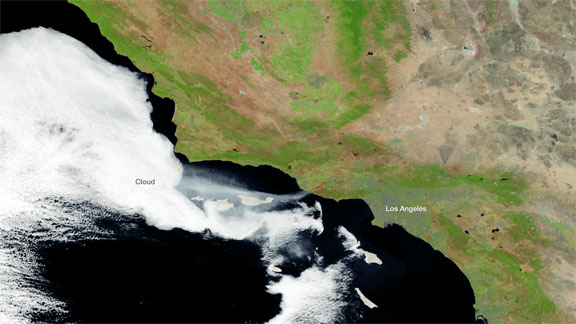
Image is courtesy of NOAA/NASA.
A stream of smoke is clearly visible moving west over the ocean, as are the heat signatures from the active fires areas. The fires are expected to be contained by May 4th, and fire weather conditions in the region seem to be improving, according to the NOAA Storm Prediction Center.