

…Middle Eastern government agency with a system that will ensure that critical military and public safety information can be shared quickly, easily and securely, even under the most demanding circumstances. The advanced geospatial intelligence solution consists of enterprise and mobile versions of Harris Corporation’s Active Catalog™ system, which enables users to manage, share, and retrieve large volumes of geospatial data—information that identifies the geographic location and characteristics of natural or constructed objects—that reside throughout an enterprise. It also provides access to live data feeds, and can generate and publish documents and map products of urban environments.
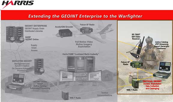
Active Catalog integrates with a variety of Open Geospatial Consortium-compliant and standard geographic information systems software, such as ESRI and Bentley, which many customers are already using for military, intelligence and public safety operations. With sophisticated techniques to extract metadata, it supports a wide range of data formats, including overhead and aerial imagery, maps, intelligence reports, sensor data and other derived products. Data and metadata are shared easily between enterprise and remote versions of the system via a secure, efficient and configurable sharing facility. Remote users can efficiently access enterprise-based geospatial intelligence data and also send field-collected information back to the enterprise.

Harris Atlas Systems LLC is a joint venture between U.S.-based Harris Corporation and Atlas Telecom, a UAE-based technology leader.
