• Skip to primary navigation
  • Skip to main content
  • Skip to primary sidebar
  • Skip to secondary sidebar
  • Skip to footer
  • NEWS:
  • SatNews
  • SatMagazine
  • MilSatMagazine
  • SmallSat News
  • |     EVENTS:
  • SmallSat Symposium
  • Satellite Innovation
  • MilSat Symposium
  • SmallSat Europe

SatNews

Satellite Industry Intelligence Since 1983

Subscribe
  • LATEST
  • SatNews Events
  • Magazines
  • Calendar
  • Subscribe
  • Missions & Constellations
    • Exploration & Science Missions
    • In-Orbit Servicing & Orbital Operations
    • LEO Constellations
    • Mission Autonomy & Onboard Systems
    • Mission Deployments & Manifests
    • Navigation & PNT
    • SmallSat
    • Spacecraft & Payload Technology
    View All in Missions & Constellations →
    The Silent Overhaul: How Software-Defined Routing and Cloud Ingestion Flattened the Aerospace Hardware StackThe Silent Overhaul: How Software-Defined Routing and Cloud Ingestion Flattened the Aerospace Hardware Stack
    Hybrid Earth Intelligence: NASA Expands Commercial Satellite Data Integration in $476M Cloud-Driven PushHybrid Earth Intelligence: NASA Expands Commercial Satellite Data Integration in $476M Cloud-Driven Push
    Hybrid Edge Mobility: Contrivian Launches “Horizon Plus” to Deliver Intelligent Multi-Orbit Field CommunicationsHybrid Edge Mobility: Contrivian Launches “Horizon Plus” to Deliver Intelligent Multi-Orbit Field Communications
    Space Tech vs. Biothreat: GMV Deploys Earth Observation and AI Core to Fight Invasive Pacific Seaweed in PortugalSpace Tech vs. Biothreat: GMV Deploys Earth Observation and AI Core to Fight Invasive Pacific Seaweed in Portugal
  • Business
    • Contracts & Commercial Deals
    • Earnings & Financial Reporting
    • Events & Conferences
    • Funding & Venture Capital
    • Market Forecasts
    • Mergers & Acquisitions
    • Personnel Moves & Appointments
    View All in Business & Finance →
    The Spatial Photonics Crunch: Inside the Invisible Supply Chain Threatening Orbital Laser NetworksThe Spatial Photonics Crunch: Inside the Invisible Supply Chain Threatening Orbital Laser Networks
    Sovereign Space Expansion: Spain’s FOSSA Systems Secures €9.25M to Scale Defense Constellation and SIGINT InfrastructureSovereign Space Expansion: Spain’s FOSSA Systems Secures €9.25M to Scale Defense Constellation and SIGINT Infrastructure
    Next-Gen Spatial Intelligence: BAE Systems Secures Agreement to Build High-Resolution Vantage Satellite Buses for VantorNext-Gen Spatial Intelligence: BAE Systems Secures Agreement to Build High-Resolution Vantage Satellite Buses for Vantor
    New Lobbying Force: Top NGSO Operators Unveil “SpaceConnect Association” in WashingtonNew Lobbying Force: Top NGSO Operators Unveil “SpaceConnect Association” in Washington
  • Defense
    • Counterspace & ASAT
    • Defense Budgets & Procurement
    • ISR & Reconnaissance
    • MILSATCOM
    • Missile Warning & Defense
    • National Security Programs
    • Space Domain Awareness
    View All in Military & Defense →
    Digital Twins for Space Command: Sedaro Tapped by Space Force to Build Federated Engineering PlatformDigital Twins for Space Command: Sedaro Tapped by Space Force to Build Federated Engineering Platform
    The Strategic Redistribution of Iranian Aerospace CapabilityThe Strategic Redistribution of Iranian Aerospace Capability
    Navigating Contested Battlespaces: Military GPS Receiver Market Approaches $3 Billion Amid Electronic Warfare SurgeNavigating Contested Battlespaces: Military GPS Receiver Market Approaches $3 Billion Amid Electronic Warfare Surge
    Preparing for Day One: DARPA Solicits Tech to Rebuild Destroyed Satellite Fleets Within HoursPreparing for Day One: DARPA Solicits Tech to Rebuild Destroyed Satellite Fleets Within Hours
  • Gov
    • Export Controls & Compliance
    • International Space Agreements
    • National Space Policy
    • Space Law & Treaties
    • Space Sustainability & Debris Policy
    • Space Traffic Management / Debris Removal
    View All in Government & Regulation →
    $3.57 Billion Milestone: FCC Advanced Wireless Services (AWS-3) Spectrum Auction Concludes$3.57 Billion Milestone: FCC Advanced Wireless Services (AWS-3) Spectrum Auction Concludes
    Who Has Authority to Intervene in a Space-Based Emergency?Who Has Authority to Intervene in a Space-Based Emergency?
    Staying in Their Lanes: SpaceX and Globalstar Join Forces to Defend Spectrum ExclusivityStaying in Their Lanes: SpaceX and Globalstar Join Forces to Defend Spectrum Exclusivity
    Orbital Paperwork War: China’s Spectrum Squatting Reserves 244,000 Satellite Slots to Combat SpaceX’s LEO MonopolyOrbital Paperwork War: China’s Spectrum Squatting Reserves 244,000 Satellite Slots to Combat SpaceX’s LEO Monopoly
  • Launch
    • Launch Providers
    • Launch Schedule & Calendars
    • Launch Sites & Infrastructure
    • Rocket Technology & Vehicles
    View All in Launch →
    Arianespace fights back – possibly!Arianespace fights back – possibly!
    Direct-to-Device Momentum: AST SpaceMobile Successfully Launches Giant Next-Gen BlueBird Satellites Atop SpaceX Falcon 9Direct-to-Device Momentum: AST SpaceMobile Successfully Launches Giant Next-Gen BlueBird Satellites Atop SpaceX Falcon 9
    SpaceX’s Secret ‘Starfall’ Capsule Wins FAA Approval for Pacific Reentry TestsSpaceX’s Secret ‘Starfall’ Capsule Wins FAA Approval for Pacific Reentry Tests
    Breaking the TRL Bottleneck: Space Phoenix Systems Debuts Cost-Effective Space Test-and-Return ServiceBreaking the TRL Bottleneck: Space Phoenix Systems Debuts Cost-Effective Space Test-and-Return Service
  • Software
    • Autonomous Ground Operations
    • Data Processing & AI/ML
    • Digital Twins & Modeling
    • Ground Segment & Teleports
    • Mission Planning & Simulation
    • Space Systems Software Engineering
    • Spectrum & Licensing
    View All in Software Automation & Ground Systems →
    Powering the Automated Floor: Intralogistics Operators Must Unify AGV Charging InfrastructurePowering the Automated Floor: Intralogistics Operators Must Unify AGV Charging Infrastructure
    Poland Sovereignty: GMV to Develop Core Ground Control Platform for CAMILA ConstellationPoland Sovereignty: GMV to Develop Core Ground Control Platform for CAMILA Constellation
    Software Over the Air: FatPipe Launches Acceleration Tool to Unclog Starlink and Amazon LEO LinksSoftware Over the Air: FatPipe Launches Acceleration Tool to Unclog Starlink and Amazon LEO Links
    Three LEO Operators Bet 2026 on a Supply Chain Built for 2027Three LEO Operators Bet 2026 on a Supply Chain Built for 2027
  • Services & Apps
    • Climate & Environmental Monitoring
    • Disaster Response & Security Mapping
    • Earth Observation & Imaging
    • Maritime & Aviation Satcom
    • Satellite Communications
    View All in Services & Applications →
    National SAR Defense: Norway Selects ICEYE for Nationwide Space-Based Flood and Hazard Monitoring SystemNational SAR Defense: Norway Selects ICEYE for Nationwide Space-Based Flood and Hazard Monitoring System
    Sovereign Milestone: OQ Technology Achieves Europe’s First Drone Video Transmission via 3GPP NTN LEO SatelliteSovereign Milestone: OQ Technology Achieves Europe’s First Drone Video Transmission via 3GPP NTN LEO Satellite
    Ghost Viewers trigger secondary ripple effect on Satellite Communications (SatCom)Ghost Viewers trigger secondary ripple effect on Satellite Communications (SatCom)
    Fleet-Wide Hybrid Networks: Marlink Integrates Starlink Across 80+ Oldendorff Carriers VesselsFleet-Wide Hybrid Networks: Marlink Integrates Starlink Across 80+ Oldendorff Carriers Vessels

Here’s Looking @ Earth… Fires By The Millions (Imagery)

October 19, 2011


NASA’s Fire + Smoke site
[SatNews] NASA has released a series of new satellite data visualizations that show tens of millions of fires detected worldwide from space since 2002.

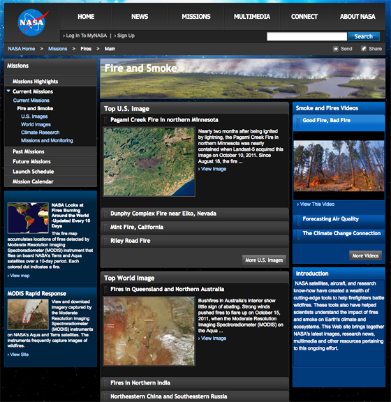
The visualizations show fire observations made by the MODerate Resolution Imaging Spectroradiometer, or MODIS, instruments onboard NASA‘s Terra and Aqua satellites. NASA maintains a comprehensive research program using satellites, aircraft and ground resources to observe and analyze fires around the world. The research helps scientists understand how fire affects our environment on local, regional and global scales.

“What you see here is a very good representation of the satellite data scientists use to understand the global distribution of fires and to determine where and how fire distribution is responding to climate change and population growth,” said Chris Justice of the University of Maryland, College Park, a scientist who leads NASA’s effort to use MODIS data to study the world’s fires. One of the new visualizations takes viewers on a narrated global tour of fires detected between July 2002 and July 2011. The fire data is combined with satellite views of vegetation and snow cover to show how fires relate to seasonal changes. The Terra and Aqua satellites were launched in 1999 and 2002, respectively.

The tour begins by showing extensive grassland fires spreading across interior Australia and the eucalyptus forests in the northwestern and eastern part of the continent. The tour then shifts to Asia, where large numbers of agricultural fires are visible first in China in June 2004, then across a huge swath of Europe and western Russia in August. It then moves across India and Southeast Asia, through the early part of 2005. The tour continues across Africa, South America, and concludes in North America. The global fire data show that Africa has more abundant burning than any other continent. MODIS observations have shown that some 70 percent of the world’s fires occur in Africa. During a fairly average burning season from July through September 2006, the visualizations show a huge outbreak of savanna fires in Central Africa driven mainly by agricultural activities, but also driven by lightning strikes. Fires are comparatively rare in North America, making up just 2 percent of the world’s burned area each year. The fires that receive the most attention in the United States — the uncontrolled forest fires in the West — are less visible than the wave of agricultural fires prominent in the Southeast and along the Mississippi River Valley. Some of the large wildfires that ravaged Texas this year are visible in the animation.


Artistic rendition of NPP Satellite, courtesy of NOAA
NASA maintains multiple satellite instruments capable of detecting fires and supports a wide range of fire-related research. Such efforts have yielded the most widely used data records of global fire activity and burned area in the world. NASA-supported scientists use the data to advance understanding about Earth’s climate system, ecosystem health, and the global carbon cycle. NASA’s Applied Sciences Program seeks out innovative and practical benefits that result from studying fires. For example, the program has found ways to integrate space-based wildfire observations into air quality models used by the U.S. Environmental Protection Agency that help protect public health. NASA will extend the United States’ capability to monitor and study global fires from space with the launch this month of the National Polar-orbiting Operational Environmental Satellite System Preparatory Project, known as NPP. The satellite is the first mission designed to collect data to increase our understanding of long-term climate change and improve weather forecasts. One of NPP’s new, state-of-the-art science instruments will provide scientists with data to extend the long-term global fires data record. The satellite is targeted to launch from Vandenberg Air Force Base in California on October 28th. The mission is managed by NASA’s Goddard Space Flight Center in Greenbelt, Maryland, for the Earth Science Division of the Science Mission Directorate at NASA Headquarters in Washington.

MODIS data are processed by the MODIS Advanced Processing System at Goddard. The algorithm and product validation is done by scientists at the University of Maryland. The visualizations were created at Goddard’s Scientific Visualization Studio. The fire, vegetation and snow data all come from the MODIS instruments on Terra and Aqua. To watch the global tour of the world’s fires, visit: https://www.nasa.gov/mission_pages/fires/main/modis-10-overview.html.

Filed Under: Earth Observation & Imaging

Primary Sidebar

Coverage

  • Missions & Constellations
  • Business & Finance
  • Military & Defense
  • Launch
  • Software Automation & Ground Systems
  • Government & Regulation
  • Services & Applications

Most Read Stories

  • SpaceX’s Secret ‘Starfall’ Capsule Wins FAA Approval for Pacific Reentry Tests
  • American military space closed around one company in seven days
  • Analyst Projects Massive Subscription Growth for Starlink Ahead of Imminent SpaceX IPO
  • Major opportunities for 2 GHz over Europe
  • Amazon Leo Constellation Surpasses 330 Satellites Following Latest Atlas V Launch

Secondary Sidebar

Footer


Satnews is a leading provider of satellite news, events, publications, research and other satellite industry information in both commercial and military enterprises worldwide.

Stories By Category

  • Business & Finance
  • Government & Regulation
  • Launch
  • Military & Defense
  • Missions & Constellations
  • Services & Applications
  • Software Automation & Ground Systems
  • Spectrum & Licensing
  • Startups & NewSpace Business

About Us

  • Leadership & Editorial Team
  • SatNews History
  • Free Satnews Subscription
  • SatNews Events
  • Magazines

Navigation

  • Latest Stories
  • Magazines
  • Events
  • Contact
  • Cookie & Privacy Policy for Satnews

We use cookies to ensure that we give you the best experience on our website. If you continue to use this site we will assume that you are happy with it.
x
Sign up Now (For Free)
Access daily or weekly satellite news updates covering all aspects of the commercial and military satellite industry.
Invalid email address
Notify Me Regarding ( At least one ):
We value your privacy and will not sell or share your email or other information with any other company. You may also unsubscribe at anytime.

Click Here to see our full privacy policy.
Thanks for subscribing!