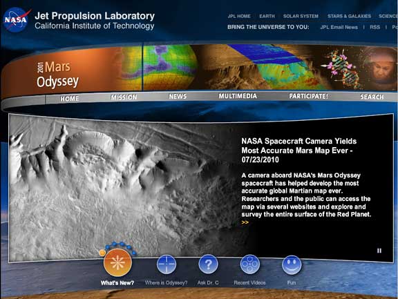
[SatNews] A camera aboard NASA’s Mars Odyssey spacecraft has helped develop the most accurate global Martian map ever. Researchers and the public can access the map via several websites and explore and survey the entire surface of the Red Planet.
The map was constructed using nearly 21,000 images from the Thermal Emission Imaging System, or THEMIS, a multi-band infrared camera on Odyssey. Researchers at Arizona State University‘s Mars Space Flight Facility in Tempe, in collaboration with NASA’s Jet Propulsion Laboratory (JPL) in Pasadena, Calif., have been compiling the map since THEMIS observations began eight years ago. The pictures have been smoothed, matched, blended and cartographically controlled to make a giant mosaic. Users can pan around images and
zoom into them. At full zoom, the smallest surface details are 330 feet wide. While portions of Mars have been mapped at higher resolution, this map provides the most accurate view so far of the entire planet. The new map is available at https://www.mars.asu.edu/maps/?layer=thm_dayir_100m_v11. Advanced users with large bandwidth, powerful computers and software capable of handling images in the gigabyte range can download the full-resolution map in sections at https://www.mars.asu.edu/data/thm_dir_100m.
Mars Odyssey was launched in April 2001 and reached the Red Planet in October 2001. Science operations began in February 2002. The mission is managed by JPL, for NASA’s Science Mission Directorate in Washington. Lockheed Martin Space Systems in Denver is the prime
contractor for the project and built the spacecraft. NASA’s Planetary Data System, sponsored by the Science Mission Directorate, archives and distributes scientific data from the agency’s planetary missions, astronomical observations, and laboratory measurements.
- Skip to primary navigation
- Skip to main content
- Skip to primary sidebar
- Skip to secondary sidebar
- Skip to footer

![]()
Satellite Industry Intelligence Since 1983
Footer
![]()
Satnews is a leading provider of satellite news, events, publications, research and other satellite industry information in both commercial and military enterprises worldwide.