

In a development that marks the end of a highly contentious period of information control, satellite remote sensing pioneer Planet Labs PBC has quietly rolled back administrative restrictions on its Earth observation data archives across the Middle East.
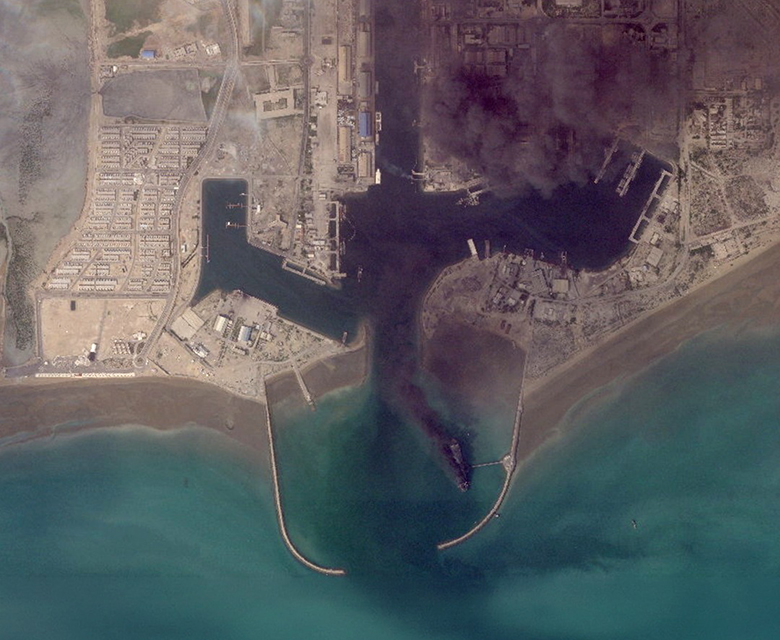
The quiet dismantling of these digital access blocks opens a floodgate of high-resolution imagery to commercial, humanitarian, and open-source intelligence (OSINT) networks that have spent months operating in an informational vacuum.
For nearly four months, the company’s vast constellation of PlanetScope and SkySat microsatellites captured the changing landscape of regional conflicts, but the data itself remained locked away. Now, as the data dams break, researchers are rushing to reconstruct a retroactive timeline of a conflict theater that was effectively hidden from public view under the shroud of government-requested “shutter control.”
The Infrastructure of Information Control
The sudden restriction of satellite access earlier this year highlighted a vulnerable truth about the modern space economy: while spaceborne data pipelines are marketed as global, independent utilities, their flow can be altered by geopolitical interests. Following major military escalations in late winter, administrative directives led to an immediate, indefinite embargo on imagery covering hundreds of critical coordinate boxes across Iran and the Persian Gulf.
Rather than turning off the cameras in orbit, Planet Labs adjusted the access parameters within its cloud-native ground segment. The raw optical data was still downlinked via Ground-Station-as-a-Service (GSaaS) networks and ingested into centralized databases, but automated software layers masked the imagery from public view. For researchers, journalists, and humanitarian agencies, entire swaths of land were replaced with data-withheld notices, creating a digital blackout during a critical geopolitical crisis.
Unlocking the Hidden Timeline of regional Conflict
With the administrative restrictions lifted, geospatial data scientists are initiating wide-scale processing loops to analyze the newly available data cubes. The restored archives provide an unprecedented, point-by-point visual record of the material destruction and structural shifts that occurred behind the curtain of the embargo.
Early analysis of high-resolution SkySat strips from the previously masked Isfahan and Bushehr sectors reveals extensive damage profiles. Unlocked imagery documents precise weapon-crater indices, structural collapses across advanced drone assembly facilities, and rapid fortifications of underground military infrastructure. Beyond detailing physical damage, the sudden availability of this historical data allows researchers to study the tactical choices made by state actors during the blackout period, turning the restored archive into a goldmine for strategic analysis.
Shutter Control and the Future of Sovereign Space Alignments
The multi-month embargo serves as a powerful case study in the evolving relationship between the commercial space sector and national defense apparatuses. Historically, “shutter control” was a rigid legal tool rarely exercised by governments. However, the rise of low Earth orbit (LEO) megaconstellations capable of daily global revisits has forced a closer integration between private space companies and sovereign security departments.
By seamlessly routing imagery through specialized security filters before it reaches commercial customers, Planet Labs demonstrated how private space infrastructure can be temporarily utilized as a tool of national security policy. As automated analytical software and machine learning pipelines continue to accelerate the speed of satellite intelligence, the boundary between commercial transparency and wartime censorship is becoming thinner, leaving the global space community to wonder when the orbital curtains might close next.
