

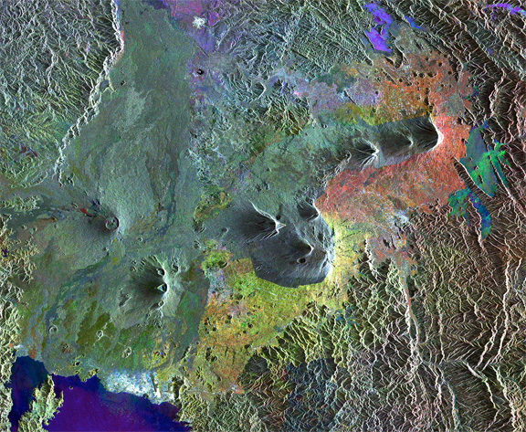
The Virunga Mountains, image courtesy of European Space Agency.
Surrounding the parklands are thousands of colourful dots that indicated changes in the land’s surface between the three radar scans that make up this composite image. These changes are primarily in vegetation as the land surrounding the mountains is blanketed with agricultural plots. There is even a clear-cut line where agricultural activities end and the protected land begins. This contrast is also evident along the DR Congo–Rwanda border, where the political boundary can actually be seen running between two volcanoes before turning southwards.
The cluster of white radar reflections along Lake Kivu in the lower-left corner is from the city of Goma in the DR Congo. This image was created by combining three Envisat radar acquisitions from March 27, 2003, January 5, 2006, and August 12, 2010, over the same area.
