

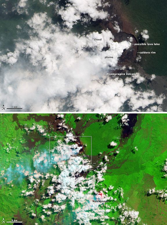
NASA Earth Observatory images by Jesse Allen and Robert Simmon, using Landsat 8 data from the USGS Global Visualization Viewer. Caption by Robert Simmon.
The source of the plume appears to be a pit nestled within the caldera that tops Nyamuragira. If outgassing magma was near the surface, intense heat would cause a bright red glow in a false-color image (lower) that included shortwave infrared light. Although no glow is visible on Nyamuragira, a glow is present on neighboring Nyiragongo Volcano, which has featured a lava lake for over a decade.
These images were collected on June 11, 2013, by the Operational Land Imager on Landsat 8. In natural color, the rainforest is dark green, clouds are white, and sulfur-rich volcanic plume is very light blue. Barren land at Nyamuragira’s summit, and lava flows, are brown or black. In false-color clouds are mostly white, and volcanic plume is cyan. Forest and other vegetation is bright green. Fresh lava flows from the 2011–12 eruption of Nyamuragira are black, and older lava flows appear as brown tendrils running down the mountain’s flanks. Agricultural fields in the southeast (lower right) corner of the image also appear brown.
