

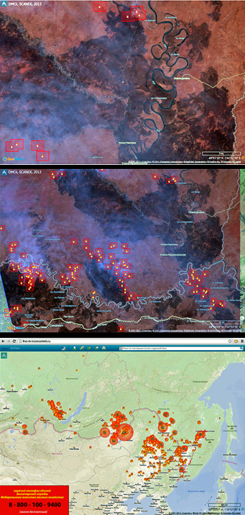
 [SatNews] ScanEx Research & Development Center carries out monitoring of natural fires on Russian territory using satellite imagery data. Starting from May 2013, the majority of thermal spots—probable fire centers—were registered by the satellites in the Far East, in Zabaikal Territory, Republic of Tyva and the Amur Region.
According to information from the Russian EMERCOM regional departments, a special fire-fighting regime was announced for the Amur Region on April 29th. The forest emergency situation incorporates the territory of five municipalities, with special fire-fighting regimes in effect in 13 municipal districts of the Republic of Tyva.
The most complicated situation built up in the Zabaikal Territory. Vast burnt areas in Khabarovsk Territory near the villages of Novokurovka and Smidovich can be seen on the UK-DMC2 satellite image, which was received and processed by ScanEx specialists on May 4, 2013. The area covered by fire along the banks of Ulika and Kur rivers (Amur basin), constituted more than 500 sq. km.
At the start of the 2013 fire-fighting period, Russia prepared an open interactive resource “Satellite-based monitoring of fires in the Far East of Russia.” This service is based on the Geomixer technology, developed by ScanEx RDC.
REFERENCE: Thermal spots are detected using MODIS sensors of Terra and Aqua satellites. The information is displayed in near real-time on the SFMS. Satellite-based monitoring of fires is conducted by ScanEx RDC. High resolution images from SPOT 5 and UK-DMC2 satellites are used for analysis of the burnt areas and for damage assessment.
