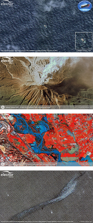
Recent events that have been imaged by Deimos-2 include:
—Ebro river flooding (from end of February to early March 2015, Fig.1)
—Calbuco volcano eruption, Chile (April 2015, Fig.2)
—Oleg Naydenov ship oil spill, Atlantic Ocean (April 2015, Fig.3)
—Potentially damaged area after cyclone Pam in Port Vila, Vanuatu (March 2015, Fig.4)
—Successful depiction of the IXV Campaign (February 2015, Fig.5)

[SatNews] Deimos-2, the first Spanish Very High Resolution Earth Observation satellite and the first 100 percent-privately funded European satellite, celebrated the first anniversary of its 2014 launch on Friday, June 19th.
The satellite, which is owned by Elecnor and operated by its technological division Elecnor Deimos, has traveled around the Earth approximately 5,300 times during this year. This represents a cumulative journey of more than 230 million kilometers, which is more than 560 times the distance between the Earth and the Moon and almost 1,5 times the distance between the Earth and the Sun.
During that time, the satellite has recorded a total of 18,000 images, covering an area of 3,2 million sq. km almost 6 times Spain's surface area. These very high-resolution images are particularly suitable for obtaining territorial information that is applied in a variety of different fields of activity: agriculture, the environment, climate change, safety, deforestation, management of water resources and supporting the management of crises arising from natural disasters.
The range of services currently offered by the Deimos-2 satellite is completed by those provided by Deimos-1, which can be grouped into three main areas: Agriculture, Forestry and Emergencies Services.

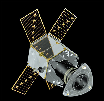
Artistic rendition of the Deimos-2 satellite.
Deimos-2’s advanced capabilities have resulted in its participation in a number of major international projects and services. Currently, the satellite is part of the EU and ESA’s (European Space Agency) Copernicus Emergency Management Services, covering emergency responses. Deimos-2 is also a key player in the CORE datasets of the Copernicus Data Warehouse,managed by ESA, carrying out a complete sub-metric mapping of Europe.

