
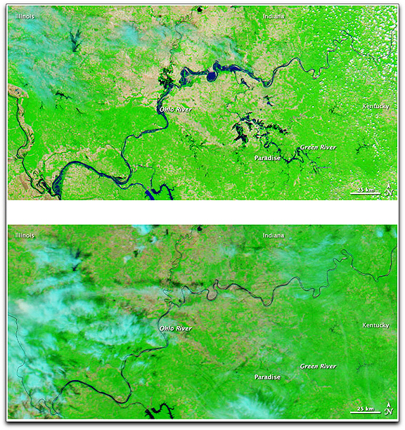
NASA image courtesy MODIS Rapid Response Team at NASA GSFC. Caption by Michon Scott.
The Moderate Resolution Imaging Spectroradiometer (MODIS) on NASA’s Aqua satellite captured these images of the region of Paradise, Kentucky, including parts of Illinois and Indiana. The top image shows the area on May 9. The bottom image shows the same area on April 29, before the floods struck. Both images use a combination of infrared and visible light to increase the contrast between water and land. Vegetation is bright green. Clouds are bright turquoise. Water is navy blue. Bare ground is pinkish-tan. At the end of April, the Green River is barely discernible, but in early May, the river is conspicuous, as are some of its tributaries. To the north, the Ohio River was substantially more swollen in early May than it was in April.