Aftermath of Minneapolis Protests_30may2020_wv3 ·
Updated by Steve Wood. Satellite image ©2020 Maxar Technologies
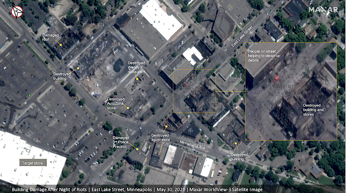
Maxar collected new imagery on May 30th, of Minneapolis, Minnesota that reveals some of the damage seen by several days of protests and rioting following the death of George Floyd.
In the imagery, many buildings, stores and restaurants were damaged by fire and looting. The imagery also shows a large crowd of people that came to help clean up debris from destroyed stores and restaurants near the East Lake Library.
Satellite imagery provides foundational context and visualization of ground conditions, empowering organizations to make critical, time-sensitive decisions. Emerging remote sensing technologies continue to broaden the capabilities of imaging satellites, providing more types of data at global scale.

