DigitalGlobe has released high-resolution satellite images of the wildfires burning in Northern California.
These wildfires have killed at least 21 people, destroyed at least 3,500 structures and have burned more than 115,000 acres.This imagery shows the fires in of the Santa Rosa, California, area taken on 10-10 and 10-11-17.

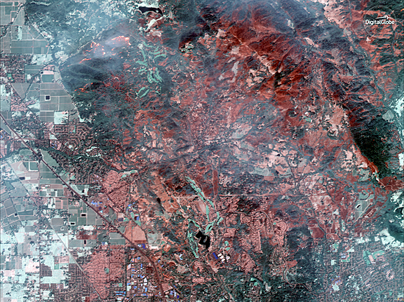
Northwest Santa Rosa and Coffee Park fires captured on October 10 by DigitalGlobe's WorldView-3 satellite. Image is courtesy
of DigitalGlobe.
The October 10 images were collected using the Shortwave Infrared (SWIR) sensor on DigitalGlobe’s WorldView-3 satellite, which is uniquely able to pierce through the wildfire smoke to see where the fires are burning on the ground.
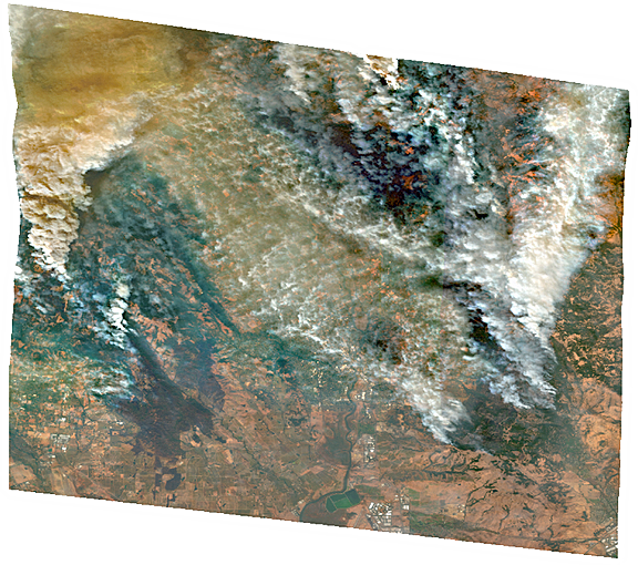
For comparison, the ground and the fire line are completely obstructed by smoke in the natural color image of the same area (see the larger overview image on the first slide).

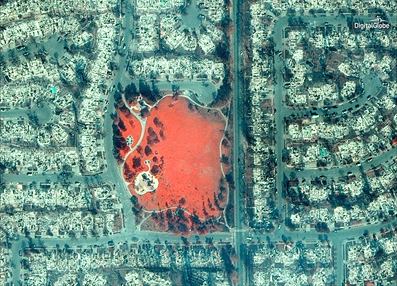
Closeup of Coffee Park area, captured by DigitalGlobe's GeoEye 1 on October 11. Image is courtesy of DigitalGlobe
The October 11 images were taken by DigitalGlobe’s GeoEye-1 satellite. Some of these are natural color, while others are shown in the Very Near Infrared (VNIR), where burned areas appear gray and black and healthy vegetation is red.
Additionally, DigitalGlobe has activated its Open Data Program, which provides imagery to support recovery efforts in the wake of large-scale natural disasters. Pre- and post-wildfire imagery of the affected areas are available to emergency responders on the Santa Rosa wildfires page.

Additionally, pre- and post-wildfire imagery of the affected areas are available to emergency responders on the Santa Rosa wildfires page.

