
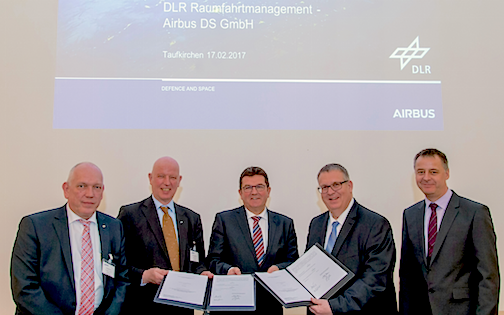

In a first, the two European nations of France and Germany have resolved to seek a deeper understanding of the mechanisms that influence Earth’s climate, and in doing so have signed a contract with the Space Administration at the German Aerospace Center (DLR) to develop and build all components of the German contribution to the German-French Earth observation mission MERLIN. The German Aerospace Center and the French space agency Centre National d’Études Spatiales (CNES) are pooling resources to develop MERLIN, whose mission is to measure the methane content of Earth’s atmosphere to improve the understanding of weather variables.

Airbus in Ottobrunn is the industrial prime contractor on the German side that was commissioned by DLR to develop the payload and the payload ground segment. As the industrial prime contractor for CNES, Airbus in Toulouse is responsible for the overall system, the satellite platform and integration of the instrument. Precise global measurement and mapping of methane concentrations in the atmosphere is only possible from space, as it requires continuous, large-area observation. Key areas such as tropical wetlands, rain forests and sub-Arctic regions are extremely difficult to survey without satellites.
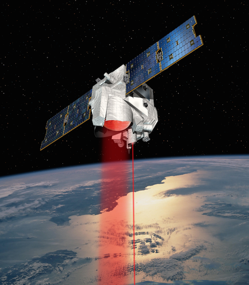
MERLIN (MEthane Remote sensing LIdar missioN) will deploy a LIDAR (Light Detecting and Ranging) instrument to monitor the methane content in Earth’s atmosphere.
To date, the methane concentration in the atmosphere has been measured from Earth observation satellites that use solely “passive” instruments. These utilize the sunlight scattered by the Earth’s surface to determine the content of trace gases (such as methane) in the atmosphere. They depend on daylight and only produce optimum results when skies are clear.
In 2021, MERLIN (MEthane Remote sensing LIdar missioN) will deploy a LIDAR (Light Detecting and Ranging) instrument to monitor the methane content in Earth’s atmosphere from an altitude of around 500 kilometers or 310.69 miles, and make possible the first-ever global map of concentrations of this gas. The MERLIN mission will be the first to use an “active” LIDAR instrument developed in Germany. It is equipped with an on-board light source (the laser) and can thus measure at night and even through thin cirrus clouds. The instrument emits two short light pulses at two slightly different wavelengths. As one wavelength is absorbed by the methane and the other is not, this difference between the two back-scattered signals can be measured and the methane concentration can be determined with unprecedented precision.
Dr. Michael Menking, Head of Earth Observation, Navigation and Science at Airbus Defence and Space commented, "By developing MERLIN through DLR and CNES, France and Germany are making an important contribution to better understanding the causes of climate change.”
With the aid of data on wind speeds and directions, scientists around the world will be able to convert these values into global methane flow maps and determine the actual regional effects of methane. A better understanding of the global methane cycle is urgently needed in order to reliably predict changes in climate and pursue effective climate protection.
http://www.dlr.de/dlr/en/desktopdefault.aspx/tabid-10081/151_read-21030/#/gallery/25776