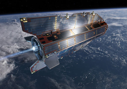
ESA GOCE satellite — the GOCE orbit is so low that it experiences drag from the outer edges of Earth's atmosphere. The satellite's streamline structure and use of electric propulsion system counteract atmospheric drag to ensure that the data are of true gravity.
In two years, the ESA GOCE satellite has collected the measurements needed to record the 'geoid' reference shape of our planet. The geoid is the shape of an imaginary global ocean dictated by gravity in the absence of tides and currents. It is a crucial reference for accurately measuring ocean circulation, sea-level change and ice dynamics – all affected by climate change. The planned mission of the Gravity field and steady-state Ocean Circulation Explorer (GOCE) satellite, launched in March 2009, included two six-month measurement periods. On March 2nd, it completed its 12th month of gravity-field mapping.

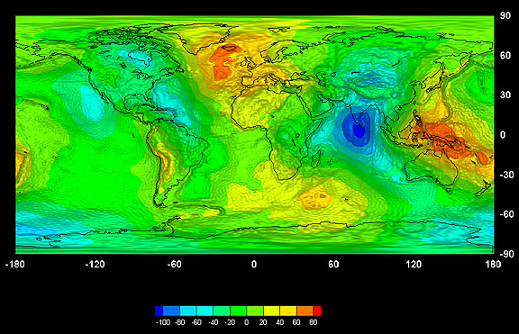
The first global gravity model based on GOCE satellite data was presented at ESA’s Living Planet Symposium. Based on only two months of data, from November and December 2009, it illustrates the excellent capability of GOCE to map tiny variations in Earth’s gravity field. Credits: ESA – GOCE High Level Processing Facility

